
To make a map is
To understand space as a story,
To engage in an investigation of place,
To honor the uniqueness of landscape and community,
To create a record in the service of memory
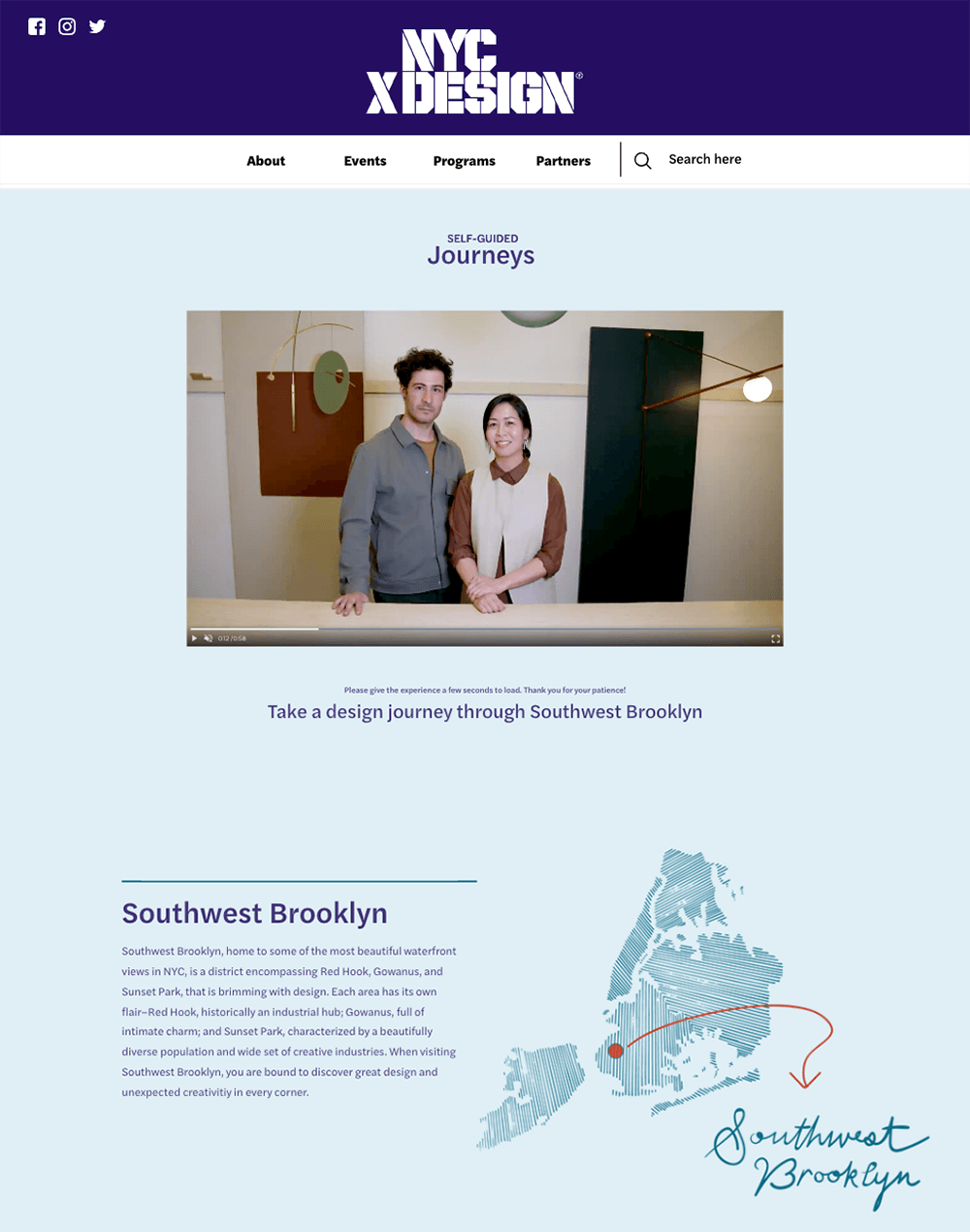
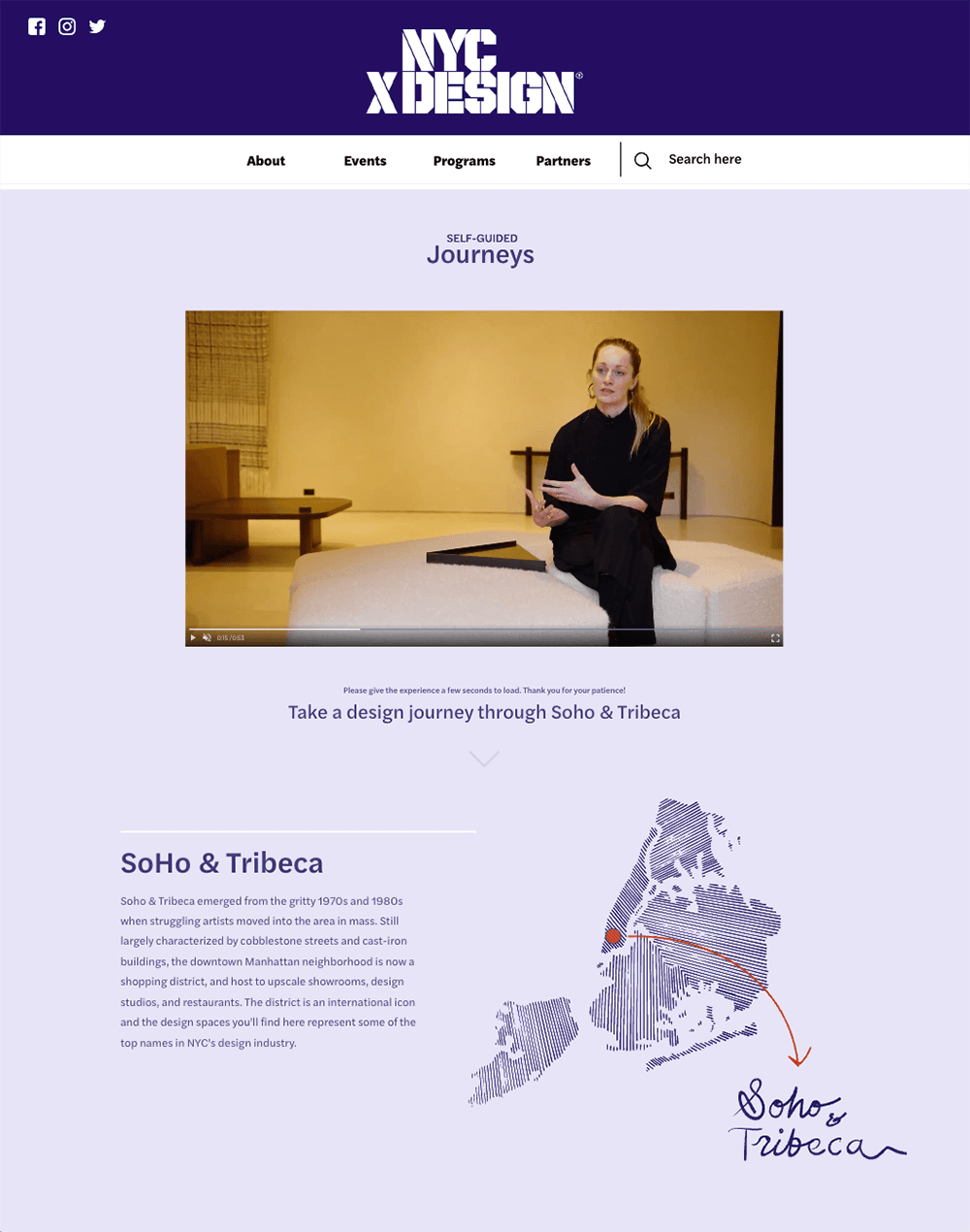
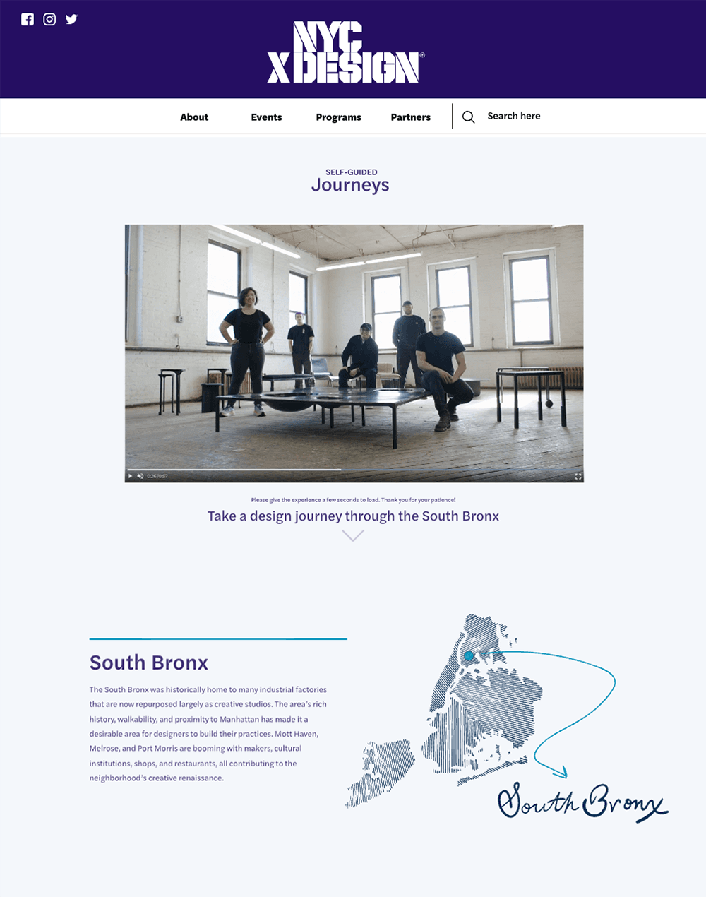
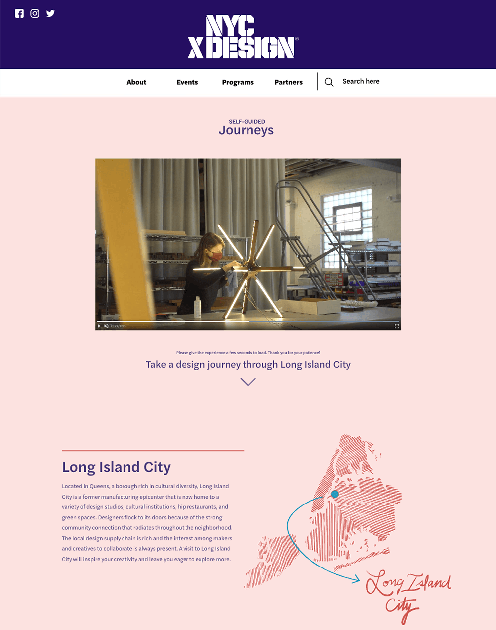
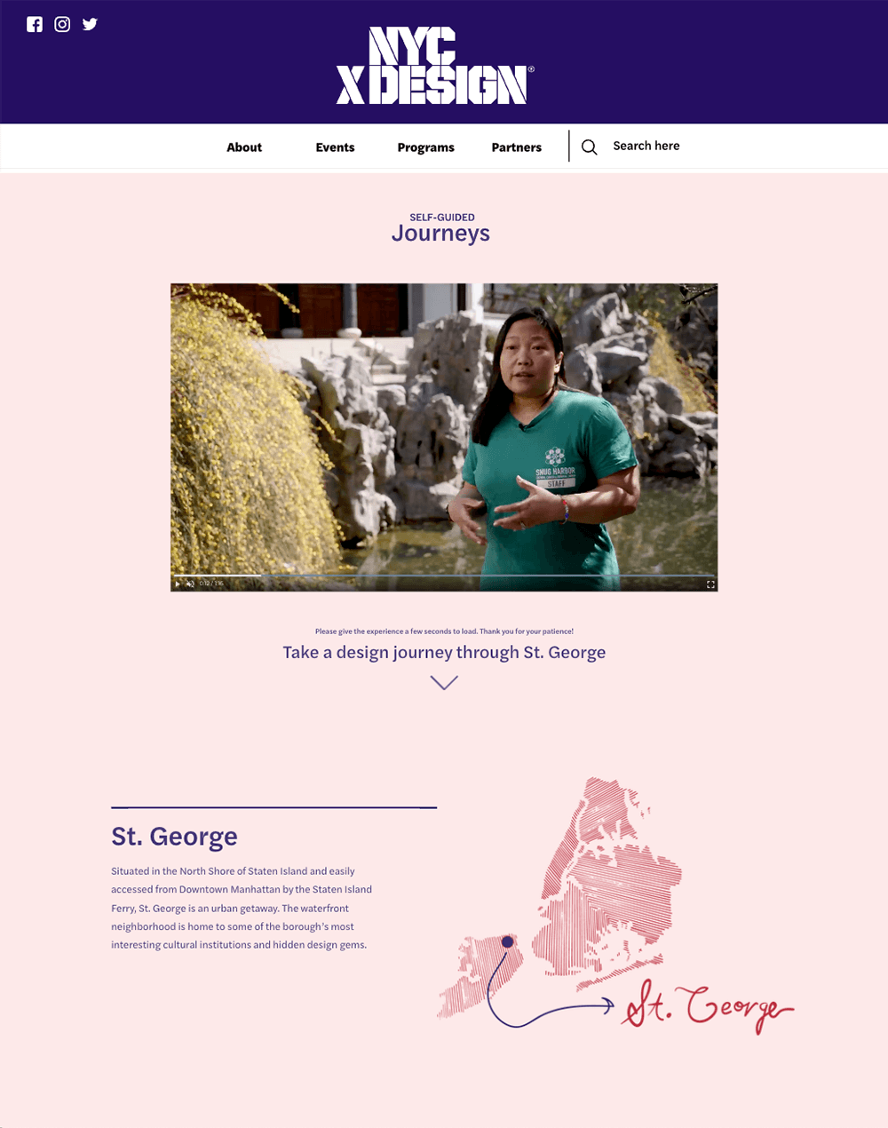
Self-Guided design Journeys
Map illustrations, icons, and hand lettering for NYCxDESIGN, 2021
To coincide with the spring NYCxDESIGN Festival, the organization wanted to create a digital-experience platform to inspire residents and visitors to embark on tours of New York City neighborhoods, remarkable for their density of creative energy.
The studio created icons of architectural sites and landmarks, photos collages of featured design studios, and a base map of the five boroughs with hand lettering. The assets were developed using the palette of the NYCxDESIGN brand identity and its prominent X mark.


Ladies & Gentlemen Studio, Red Hook, Brooklyn, ©Charlie Schuck/L&G

RUX Studios, Long Island City, Queens, ©RUX Studios


Newburgh–Beacon mural
Map illustration for Regional Connector Team and New York State Bridge Authority, 2024
Mural & Production: color cube
A custom mural-map imagining a Mid-Hudson Valley region animated and connected by a network of walking and biking trails.
Situated at the underpass leading onto the Newburgh-Beacon Bridge, it’s a project that links communities in the present, through its integration in the physical infrastructure, and in the future, by envisioning more sensitive, human-centered modes of experiencing place. It’s a project that bridges the realities of the present with the possibilities of the future, starting with a shared act of creativity.

Bridge site in Newburgh, NY


Summer in the Catskills
Map research and illustration as Independent project, 2020
A map to forest hikes, town treasures, never-ending meals, and sultry nights
Meatpacking District Plaza Guide
Site diagrams and guide layout for Meatpacking District Association, 2020
Copyediting: Theresa Duhon
Illustrative diagrams for planning activations and programming in the public plazas managed by the Meatpacking District
Google Neighborhood
Night Out X Meatpacking District
Map illustration and layout for Meatpacking District Association, 2016
A booklet with 19 iterations of nightly itineraries for Googlers to explore the Meatpacking District and Chelsea neighborhoods.
Street Vernacular of Jamaica, Queens
Research, map illustration, layout, and copy for No Longer Empty x Jamaica Center BID, 2016
Spot drawings: Marcellus Hall
Produced in conjunction with the art exhibition “Jameco Exchange” by No Longer Empty, this piece served as a neighborhood guide, navigational tool, and a snapshot of the vernacular of downtown Jamaica. The cover photo features historic street signage of the neighborhood. Inside, the custom map highlights 22 places, including shops, restaurants, architectural gems, and sites for arts and culture. Alongside each place description are hand-drawn illustrations that represent an aspect of the site’s unique graphic identity.
Croissant & Coffee Guide
Map research, illustration, and copy as independent project, 2018
In pursuit of breakfast à la Julia Child: coffee in one hand, croissant in the other, and an eye open to the stage of the city.